


The Merlin Burrows Scans I
A Modern Search for for an Ancient Archive


A Quest Reignited
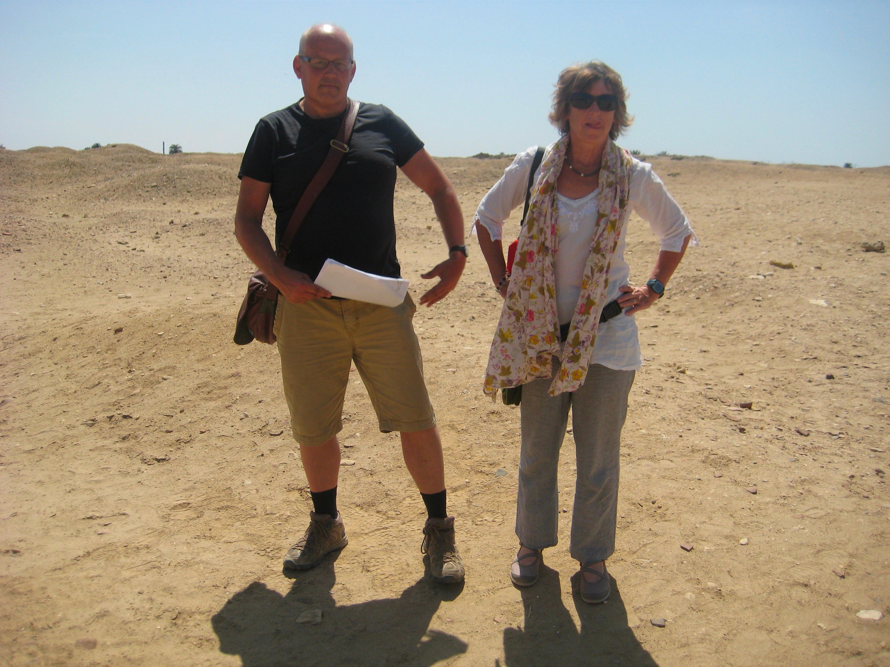
In the tranquil embrace of the Alpujarra’s verdant valleys, where the whitewashed village of Cádiar cradled our writer’s studio, a restless spirit stirred. Months had elapsed since our exhilarating sojourn in Egypt with the indomitable Carmen Boulter1. Serenity had returned to the green valleys where, a year prior, Andrew Barker and I embarked on our quest to pen a book unveiling Egypt’s Hawara Labyrinth. Dust gathered on the bookshelves, yet Andrew’s resolve burned unyieldingly. A sacred flame ignited within him to reveal the labyrinth at Hawara, that grand subterranean wonder whispered to be the lost Library of Atlantis—a relic of an Ice Age civilization that crumbled some 12,000 years ago. That epoch, shattered by solar storms, cosmic debris breaching our biosphere, earthquakes, volcanic eruptions, floods, droughts, and the relentless climate shifts from melting icecaps, brought even the mightiest civilization that probably ever existed to its knees. Was the labyrinth their “ark of knowledge,” a beacon to enlighten future generations with the wisdom of harmonious coexistence with nature and a warning, carved deep into its stone walls, of the return of those cataclysmic cosmic cycles? Cycles that, as I write, seem to stir our planet once more? Like a steadfast English knight, Andrew seized the sword, embarking on what would become the most heroic battle of his life, tinged, as epic tales often are, with a hint of tragedy.
The Technology: Holographic Depths
June 2015. A WhatsApp voicemail crackled through on my mobile: “Andrew here. Could you come over? There’s something I need to tell you.”
At 10:00 the next morning, I found him in the refectory of the Alqueria de Morayma2, an oasis of Andalusian peace, enveloped by vineyards, almond groves, and the scent of orange blossoms. At a grand, weathered Spanish table, strewn with documents, maps, notebooks, and his dust-laden laptop, Andrew sat, eyes alight with purpose.
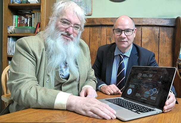
“This is the man, Louis!” he declared, introducing Timothy Akers, an ex-military tech researcher and programmer who had honed his craft in the British Army’s satellite scan security division. A man who is now channeling his passion for antiquity into his start-up company, Merlin Burrows—turning his military expertise to probing ancient sites with cutting-edge satellite technology.3
Andrew’s discovery of him was serendipitous—a small blog post by Akers about the colossal statues said to have once stood in Lake Moeris4, near the Hawara Labyrinth. Akers’ scans had confirmed the presence of dual pyramids that once supported those statues, a tantalizing clue to the labyrinth’s proximity.
“I reached out, told him about our labyrinth research, and the guy went wild. So wild, he called in old comrades still buried in the military industrial complex to process the satellite data using their top-tier systems—something that would’ve taken him years on his own.”
It sounded both thrilling and absurd. Skepticism shadowed my excitement. I had my share of “remote sensing” claims. Yet here was a man with broad shoulders, a beard fit for a Norse god, and a home-knitted jumper big enough to house a horse. I remained cautious.
“Tomorrow, the first processed satellite scans will arrive,” said Andrew, his voice trembling with anticipation. “Alright,” I said, cautious. “But explain it to me—how does this work, really?” Pressing for clarity, wary of another round of woo-woo tech promises.
Without pause, Andrew drew a crisp white sheet from his weathered leather bag, itself scarred from the dust of Hawara, the bustling markets of Fayoum, and a dozen sips of shisha water-pipes along the way.
“To understand what Tim is doing, let me explain first how a holographic image emerges from a flat photograph, as this is key to how Tim creates a 3D image of Hawara’s depths from a satellite scanning only the surface.” He began: “Picture a pan filled with water. Drop several pebbles into it, and ripples form, colliding into intricate wave patterns. If you could freeze that water instantly and lift out the ice, shining a light beneath would project a 3D image of the pebbles at impact—a hologram born from frozen ripples. Tim’s technology does this on a grand scale, and with far greater precision.”
Tim’s system sourced high-frequency satellite images—already purchased by Andrew—from private orbital agencies. Typically, these were run through custom software on his own servers. But this time, through old military contacts, they would be processed deep inside classified facilities beneath the UK, places where processors that once tracked submarines hiding behind tankers would now be focused on Hawara.
“This tech could detect a sub’s path by analyzing the residual water ripple field left behind—fluid footprints,” Andrew explained. “Now imagine what it can do when scanning solid geological formations, vibrating on the Earth’s constant geophysical activities. This tech can map the underground in 3D up to 5 kilometers deep, distinguishing between granite, diorite, limestone—even mapping voids, tunnels, and metallic anomalies with uncanny precision. Down to the size of a golden watch.”
The Scans: A Subterranean Marvel
The next day brought what Andrew later called "the Skype call of a lifetime.” Tim appeared—radiant, grinning, a prophet of pixels, his voice booming: “Oh boys, oh boys…” he said. “Hold on. Here it is.”
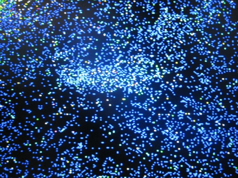
And then it appeared. Not a crude overlay of red lines on Google Earth printouts, like Klaus Dona’s friend scans, but a real, textured, vividly rendered subsurface scan. It was breathtaking. Clear. Crisp. Detailed.

Colorful, intricate images flooded our screen — vivid, detailed, a technological marvel that felt like the real deal. The epitome of a high-definition satellite scan. My pulse quickened—these could reshape our understanding.
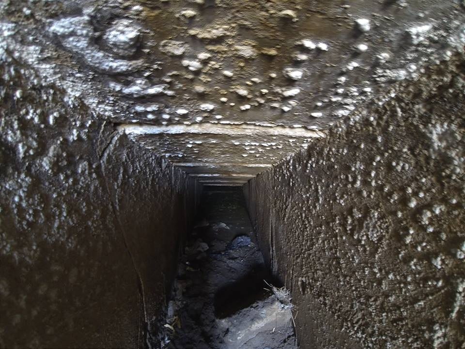
Yet, the scans5 overlooked once again my primary interest: the layer beneath Flinders Petrie’s 304m x 244m foundation, between -5 (Petrie’s foundation6 ) and -18 meters (start of the solid bedrock), where my 2008 Mataha Expedition7, in collaboration with NRIAG8 and Ghent University, revealed vast chambers with massive walls. Instead, like Klaus Dona’s scans, these plunged into the bedrock, unveiling a colossal complex of great halls at -40, -60, -80, -100 meters, and deeper.
Yet this time, a revelation emerged: a central open space connecting several of these layers. Like the atrium of a colossal shopping mall, where several floors converge in one grand central hall—an atrium consisting of a massive space, 40 meters wide and no less than 100 meters long—a 5:2 ratio temple chamber—followed by what appears to be a huge gate leading to a cubic space of 44 meters at the heart of the complex.9
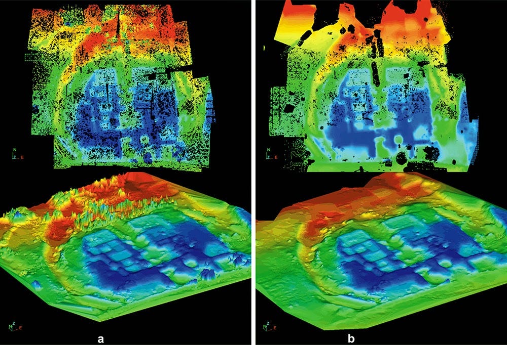
A colossal underground temple? A massive ancient archive ? A resonance chamber?
Swiftly without even giving us the time to percolate the mind-blowing impact of his words, Tim moved to another distinct feature; a clearly pronounced circular and according to him - a domed hall. Situated according to the scans some 30 meters below ground level. An underground rotunda10 approximately matching the size of the Pantheon in Rome.
My thoughts turned to Patrick Geryl’s Orion Prophecy, and the French scientist and Egyptologist Albert Slosman’s11 translations of the Egyptian “Book of Death”—legends of a grand golden circular chamber, the “Circle of Gold,” deep beneath Hawara, where ancient priests inscribed mathematical prophecies in gold, warning of the cycles of cataclysms yet to come.
Could this be it?
As Andrew and Akers delved deeper into the scans, I stepped onto the vine-draped terrace, the murmurs of their conversation fading against the silhouette of the Sierra Nevada’s snow-capped peaks, glinting under the moonlight. Above, Orion’s Belt shone, its three stars mirrored in the Giza pyramids and Mexico’s Teotihuacan Complex. What message did the ancients encode in these megalithic wonders and why did it demand such monumental effort?
The Path Ahead
Weeks passed as Andrew and Akers delved deeper into the scans, strategizing entry into this vast complex. Andrew and Tim burrowed deeper into their analysis, aligning the Merlin-Burrows high-resolution scans with the archaeological records of the now-submerged Hawara pyramid, the 2008 Mataha Expedition’s geophysical data —funded and coordinated by me—, and the corroborative data from the Polish mission12 from the University of Wrocław and Cairo University at Hawara later that same year. All confirmed what Herodotus described over 2,000 years ago: a tunnel connecting the labyrinth and the pyramid. Their conclusion was sobering in its simplicity: the most direct entry to the labyrinth lies through the submerged pyramid itself!
Orion’s Message
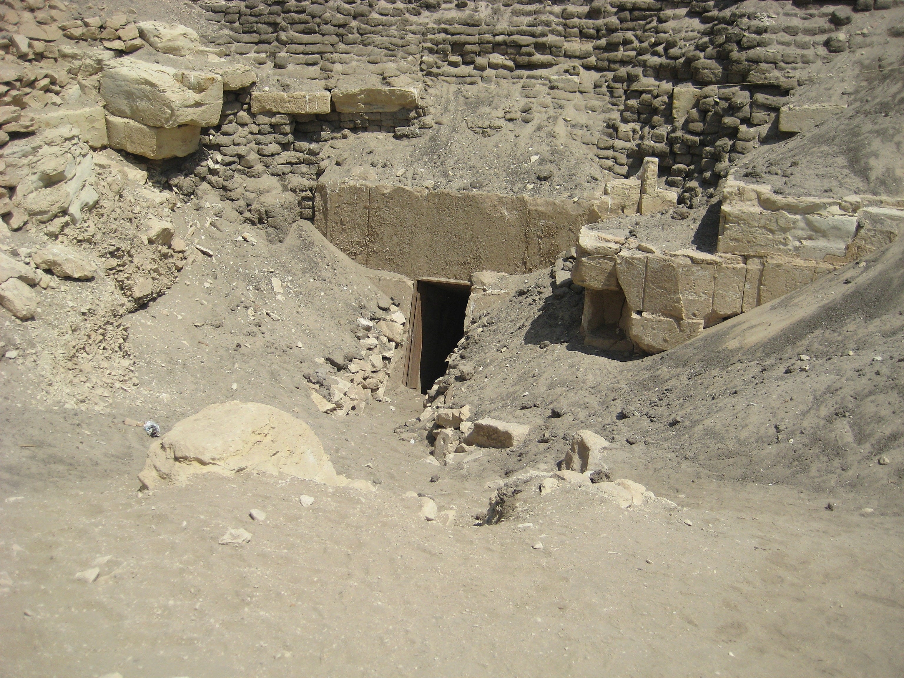
Yet, access was thwarted. Irrigation from nearby rice fields and a channel dug by French Freemason Linant de Bellefonds13 in the 1830s—builder of the Suez Canal—had flooded the site. This water barrier, unaddressed by Zahi Hawass14 and the Department of Antiquities, seemed less neglect than a deliberate obstacle, guarding what might be humanity’s greatest archive—a stone library holding the ancients’ most vital message.
In all this, one man’s shadow loomed large: Zahi Hawass.
The former head of Egypt’s Supreme Council of Antiquities had long denied the possibility of the labyrinth’s existence. He had blocked access to Hawara for years, dismissing alternate findings, downplaying satellite scans, and rejecting our applications for renewed excavation and even the urgent preservation of Hawara , due to shallow groundwater that is actively eroding the pyramid15.
We are closer than ever.
Yet the doors remain closed. And the silence beneath Hawara presses on.
Above it all, Orion still glows—its belt aligned with monuments across the ancient world—echoing a celestial message encoded in stone, waiting for humanity to remember its place among the stars.

Alqueria de Morayma; once a traditional group of homesteads and farm buildings.
Has been transformed into an hotel/ appartement complex; situated on the southern flank of the Sierra Nevada mountains on a rise above the river Guadalfeo , it enjoys panoramic views of the Sierra Nevada National Park > www.alqueriamorayma.com
Merlin Burrows -Note on the Development and Legal Transfer of the Hawara Scans- At the time of the Hawara satellite scanning in 2015, Merlin Burrows—then operating as a satellite scanning initiative—had not yet been legally incorporated. The venture was originally developed by Timothy Akers as a pre-incorporation entity, with formal registration taking place several years later in Harrogate, North Yorkshire, in collaboration with Bruce Blackburn, who now serves as CEO of Merlin Burrows. The Hawara satellite scanning project was commissioned and funded by Mr. Andrew Barker, who legally transferred the agreed funds directly to Timothy Akers in exchange for the execution of the scanning work. Accordingly, Mr. Barker held full copyright ownership and legal rights to the resulting satellite scans, data, and associated findings, with complete freedom to utilize or distribute the materials at his discretion. In accordance with the project’s cultural and humanitarian aims, Mr. Barker later transferred these rights to the Belgian non-profit organization, The Cosco Foundation, for continued guardianship and public dissemination. The Cosco Foundation, established by Louis De Cordier—coordinator of the 2008 Mataha Expedition—carries forward this mission, ensuring that the knowledge uncovered is preserved, studied, and shared with the world. It is with respect that we acknowledge the passing of Timothy Akers in 2022, whose early technical contributions played a key role in initiating this important work. For information on Merlin Burrows: www.merlinburrows.com
Lake Moeris was an ancient endorheic freshwater lake located in the Faiyum Oasis, 80 km (50 mi) southwest of Cairo, Egypt, which persists today at a fraction of its former size as the hypersaline Lake Qarun (Arabic: بركة قارون). In prehistory it was fed intermittently by the Nile via the ancient Hawara Channel, fluctuating in level throughout the Paleolithic and Neolithic periods. > https://en.wikipedia.org/wiki/Lake_Moeris
HD scan version can be downloaded here > Hawara Satellite Scans_MB_June2015


The National Research Institute of Astronomy and Geophysics (NRIAG) in Helwan, Egypt, is a multi-faceted research institution with several departments dedicated to studying Earth and space. > https://www.nriag.sci.eg/
Erratum – Dimensional Revision:The previously cited spatial dimensions of the central atrium and adjoining chamber (64 × 160 m atrium; 80 × 80 m chamber) were based on the original data available in 2015. Subsequent analysis by Merlin Burrows employing updated reference points and refined spatial calibration, revised these figures to an atrium of approximately 40 meters wide by 100 meters long—retaining the symbolic 5:2 proportion—followed by a central chamber measuring 44 × 44 meters. These corrections reflect a more accurate interpretation of the spatial configuration, ensuring consistency with both the architectural context and the latest digital reconstruction methodologies. The author acknowledges the earlier overestimation and welcomes this clarification as part of the evolving understanding of the site.
Rotunda, a room within a building that is circular in plan and covered with a dome. An example of a Classical Roman rotunda is the Pantheon erected at Rome about ad 124.
Albert Slosman (1925–1981) was a French mathematician, computer scientist, Egyptologist, and author whose research focused on uncovering the lost roots of ancient civilizations—particularly the link between prehistoric cataclysms and early Egyptian culture. Originally a scientist working with NASA on early computing projects, Slosman turned to ancient texts and archaeology after a near-death experience during World War II. He came to believe that the origins of Egyptian civilization were far older and more cosmically informed than mainstream Egyptology allowed. His central thesis was that a highly advanced civilization—referred to as “Aha-Men-Ptah”, the “Land of the West”—existed on a continent now lost to the Atlantic Ocean. This civilization, he argued, was destroyed by a global cataclysm (a pole shift or flood) roughly 12,000 years ago. Survivors fled to Egypt and established the first dynasties, preserving fragments of their scientific and spiritual knowledge. https:atlantipedia.ie/slosman-albert
Polish Mission March 2008 survey of the Hawara pyramid (Cairo University - Wroclaw University). General Director Prof. Dr. Alaaeldin Shaheen, Dean of the Faculty of Archaeology of Cairo University.
Linant de Bellefonds: The canal construction of the Bahr Wahbi by the French engineer Linant de Bellefonds between 1830 – 1835, is normally not classified as an archaeologic expedition, but it certainly needs consideration. Seen the archaeological interests of the French engineer and the higher elevation of the pyramid base, we can presume that Linant de Bellefonds intentionally directed the canal towards the pyramid, in order to cross the labyrinth area. The digging of the canal, as a giant archaeological cross section, surely must have unearthed many antiquities. Per contra, Petrie’s alleged labyrinth foundation remained untouched, like the canal does not reach the according depth.
Dr. Zahi Hawass, the Secretary General of the Supreme Council of Antiquities (Egypt). Since the release of the scan results at the Ghent University public lecture of 28th October 2008, Dr Zahi Hawass requested to stop communicating our results, intimidating the Mataha Expedition team members with Egyptian National Security sanctions. Ever since all applications to continue research and the preservation of the Hawara Necropolis and its pyramid are denied by the the Supreme Council of Antiquities. The Mataha-expedition UGent public lecture guest speakers were: Prof. Dr. Paul Van Cauwenberge (Rector Ghent University), Prof. Dr. Moustafa Kamel El- Ghamrawy (Faculty of Engineering, Al Azhar University, Cairo & Member Supreme Council of Antiquities), Prof. Dr. Alaaeldin Shaheen (Dean faculty of Archaeology, Cairo University & Member Supreme Council of Antiquities), Prof. Dr. Abbas Mohamed Abbas (National Research Institute of Astronomy & Geophysics, Director of the Hawara Geophysic Survey and Member of the Egyptian Committee of the Protection of Antiquities from Environmental Effects), Mark Beaver HORUS Foundation (US), Prof. Dr. Peter Vandenabeele (Ghent University, Department of Archaeology and Ancient History of Europe), Prof. Dr. Johan Braeckman (Ghent University, Department of Philosophy), Guy Bovyn (Kunst-Zicht, Curator Mataha-project: curator Contemporary Art Ghent University; coordinator of the postgraduate program ‘Exhibition and Conservation of Contemporary Art’), Louis De Cordier ( Mataha-expedition coordination & concept).
Hawara: Seventeen Years After

Sierra Nevada Mountains, La Alpujarra. A solitary refuge in the drylands of southern Spain, south of Granada. Here, in the shadow of these rugged peaks, I have lived for years, far removed from the noise of t…